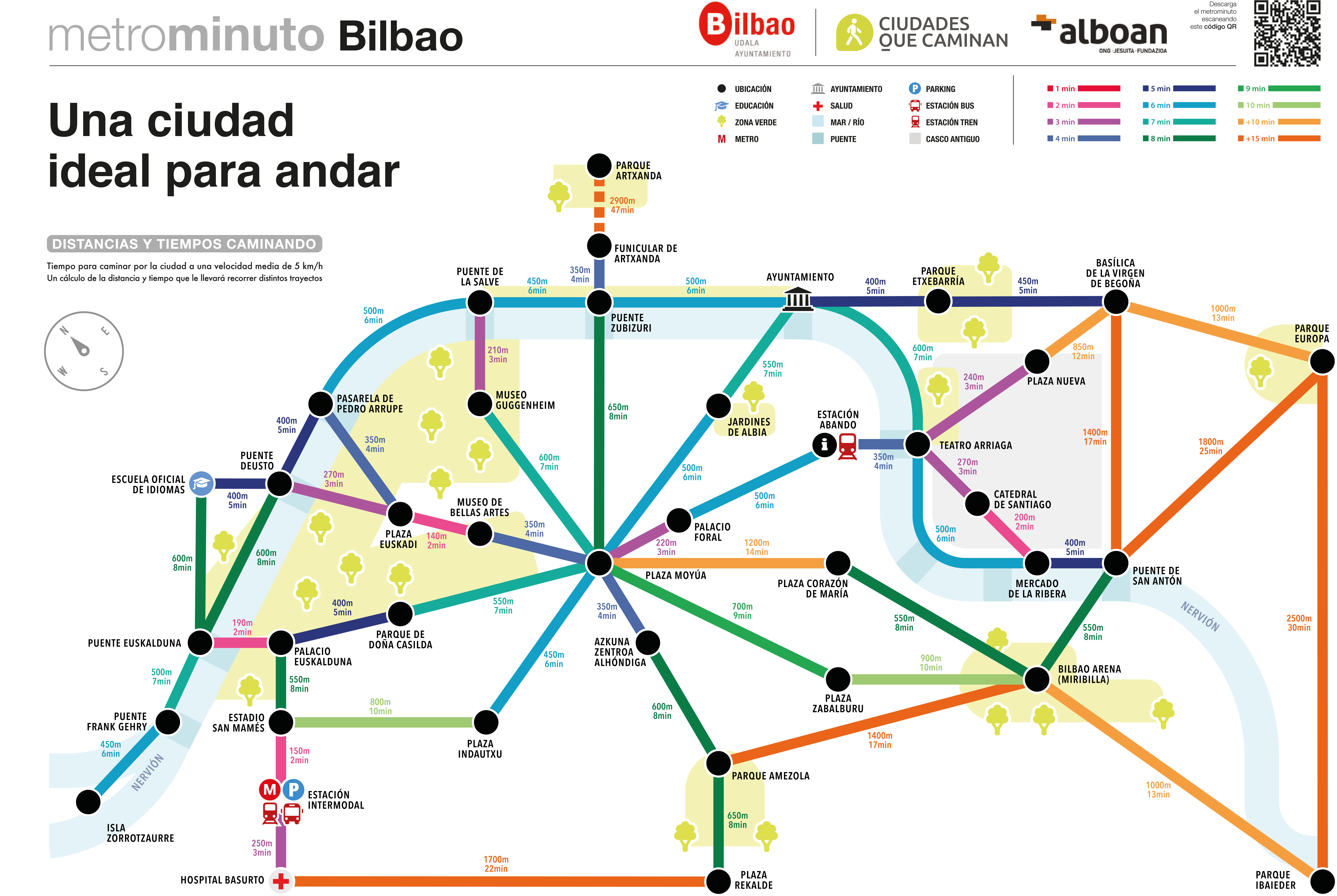
Bilbao presents “metrominute”, the map showing the main points of the city to encourage more pedestrian travel

The Area of Mobility and Sustainability of Bilbao City Council are not content with the high number of journeys made on foot, 65% of all the internal journeys made every day in the city. To step up this excellent figure, the Deputy Mayor and Councillor for the Area, Nora Abete, today presented “Metrominute”, the map that measures the distances and times taken to walk between the main points of the city. This comes as part of the programme of activities organised for European Mobility Week (SEM 2023).
Metrominute is a synoptic map that measures the distances and times taken to walk between several points of each city. The map shows the key points in each city (services, squares, parks, neighbourhood centres…) and the distance between them, expressed in metres and in minutes. It uses the visual codes of metro maps, in a nod to an important mode of transport in big cities, but applied to pedestrian travel.
The map aims to raise awareness about the walking culture, highlighting the proximity between recognisable spots in the city. As the distances are small and the times short, this encourages us to walk to our destination, choosing pedestrian transport for our journeys.
This project also seeks to call attention to the importance of building compact, dense and diversified cities, where everyday amenities and services can be found within a walk of ten or fifteen minutes, making the famous theory of the “fifteen-minute city” happen. This would be the time taken to reach the main destinations or public transport stops that we need in our everyday life.

